Why was there pond here before? The geological location of Tempelhof is exciting. The landscape here used to be strewn by many small water holes. Find out more about the Ice Age and the ground beneath Tempelhof.
“The earth has a migration history”
Let’s go underground! Two experts in geology, Ulrike Hörmann and Dr Beate Witzel, talk about stones and their origins, sheets of ice a hundred metres thick, and why we can be thankful for ice ages.
Audio transcription
Here you will find the podcasts audio transcription >>
W: “My name is Beate Witzel and I’m waiting for my friend Ulrike Herrmann. We want to talk about the geology of Tempelhof here at Reinhardtplatz. It’s always fascinating with Ulrike – she studied geology, works for Berlin’s state geology office and simply knows an incredible amount. Here she is – hi, Ulrike!”
H: “Hi, Beate, great to see you. Thanks for taking the time from your work with the geology collection at the Stadtmuseum to meet here at Reinhardtplatz. I’ve always wanted to ask what interests you the most about Berlin’s geology.”
W: “You know what I find really exciting? The ground beneath our feet isn’t from Berlin. The sand, gravel, loam, clay, stones and boulders were dragged here by glaciers during the ice ages. The earth here has a migration history. It came from Scandinavia. Or that’s one way of interpreting it. As temperatures cooled around the world, glaciers were able to move from the polar region across Scandinavia and to the North Sea and Baltic Sea regions and then to us here in northern and central Germany.”
H: “We can single out three different ice ages or glaciations here: the Elster, Saale and Weichselian. Each made multiple advances and then retreated when their inland ice masses melted. On their extensive travels, the glaciers scraped up many and different stones from the earth, took them along, and ground them up intensively on the way to us, at times quite finely.”
W: “And when the ice melted, that material remained here on the ground?”
H: “Did you know that the ice age sedimentation here is 100 metres deep? That means we’d have to dig down 100 metres to get to the original ground. That’s precisely what was studied in the nearby borehole funded by the Berlin state senate. In fact, Berlin would actually lie 40 metres below sea level here, and we could only be meeting in boats or on air mattresses if these glaciations hadn’t occurred. We owe a lot to the ice ages!”
W: ”And Ulrike, what do you find so exciting?”
H: “I’m impressed by the incredible extension and thickness of the glaciers. There used to be massive sheets of ice in northern Germany that reached a thickness of nearly 1,000 metres in the Elster ice age, or even 200 metres still in the Weichselian age, which means we’d be meeting for coffee up in the sphere of the TV tower on Alexanderplatz where we’d barely be able to look straight out onto an expanse of glacial landscape.”
W: “Fortunately, however, there weren’t just the three ice ages, but also the warmer periods in between. Temperatures then were even considerably higher than today, and there was more rainfall. But these warm periods only lasted 15,000 years and the ice age 100,000 years. So things were more on the cold side?”
H: “Indeed! In the interglacial periods the environmental conditions went through huge changes. During the Holstein warm period following the last ice age around Berlin, an extensive landscape of lakes arose, where animals like river snails really felt at home. Sedimentation conditions were largely calm and the deposits consisted primarily of clay and mud, often containing masses or even banks of these river snails which are now a major Berlin fossil. We’ve got a very impressive sample in the geological collection. The snails were first found here in Tempelhof, by the geologist Albrecht Kunth. There was a gravel pit here, and he excavated them. They were named after him, Paludium diluviana Kunth. There’s a school now where the gravel pit used to be, the Askanisches Gymnasium, and it has a plaque in his honour. A lot of Tempelhof’s residents are surely familiar with it!”
H: “Listen, ice ages and warming periods have created a lot of special features in Berlin. It’s also important to know that the Weichselian ice age only ended around 11,000 years ago, and it was the one with the biggest influence on Berlin’s landscape. It formed the Teltow plateau, on which we’re sitting here at Reinhardtplatz, the northern valley next to it that carried melted ice from the glacier northwest toward the North Sea, and the Barnim plateau further to the north. In densely populated urban areas, however, geology is usually not that obvious.”
W: “But it’s different here in Berlin. All the elevations, hollows, lakes, ponds – everything was formed and left behind during the ice age. We also have all these ancient boulders from Scandinavia – often more than a million years old – in our young city. On a lot of them you can even see exactly where the glacier broke them off. In fact you could even stick a stamp on them and say, ‘Return to sender!’”
H: “But not all of them please! We’re also finding new ones, of course, especially at construction sites, and protecting them as emissaries from the ice ages. One of these natural monuments is right here in the park, by the way. It’s gneiss or migmatite with five cubic metres of gneiss.”
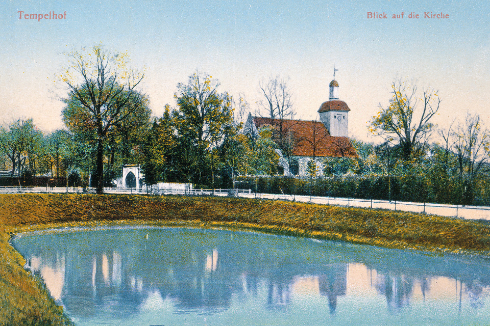
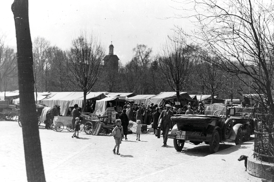
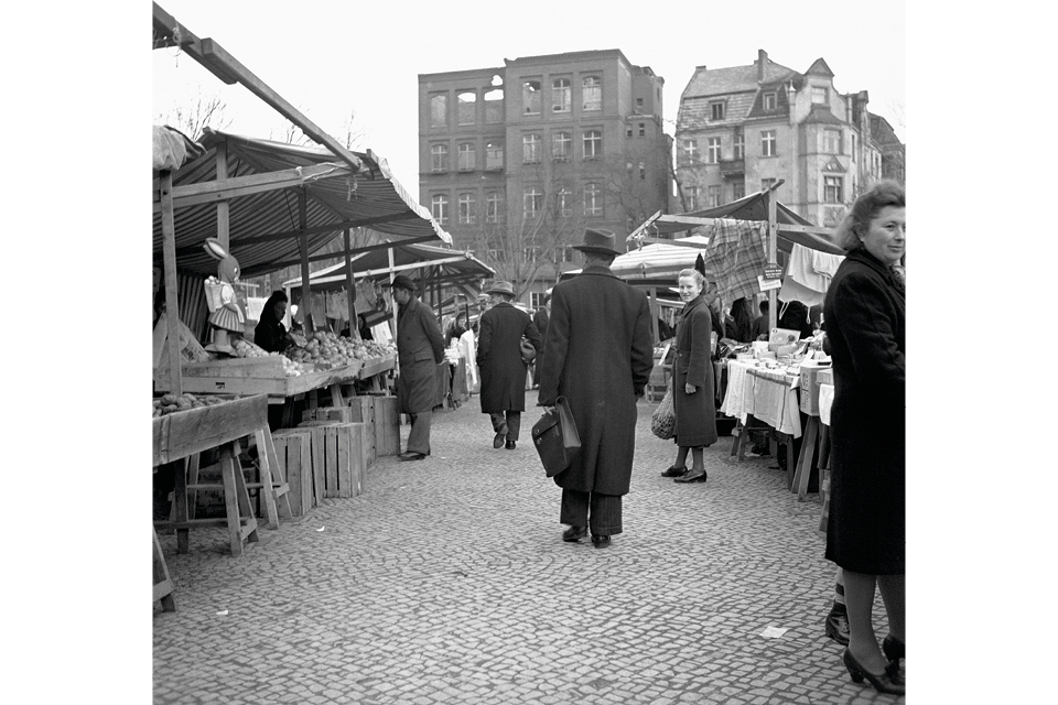
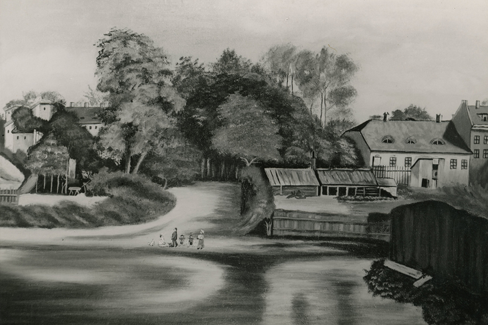
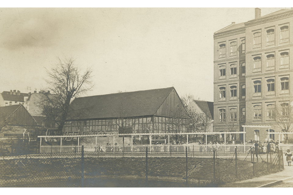
Where you now see trees, parked cars and cyclists, there was a body of water until the early 1900s. Old maps show a pond called the “Grundpfuhl” where Reinhardtplatz is now. It might have been part of a system of waterways used to defend the compound of the Knights Templar near the village church. In 1905 the “Grundpfuhl” was filled with excavated soil. After the second world war, the area was a marketplace. The name “Reinhardt” for the square and nearby street commemorates Carl Franz von Reinhardt, a member of the village council who oversaw finances. He owned the knights’ estate from 1749 to 1796.
The earth under Tempelhof
Today’s district of Tempelhof lies on the Teltow plateau. The Teltow plateau, the Warsaw-Berlin glacial valley and the Barnim plateau have formed Berlin’s topography and shaped its natural features. The Warsaw-Berlin glacial valley has swamp-like wet soil. This often complicates construction in the city centre. High groundwater levels mean that excavations quickly fill up with water. The purpose of the big blue and pink pipes you see above ground is to carry groundwater away from construction sites. The soil of the Teltow plateau, however, is different. Its upper layer is from the Weichselian period, whose glaciers covered Berlin 24,000 years ago. When a glacier moves over land, it pulls rocky material from the earth and grinds it under its enormous weight. When the ice melts, this rocky debris remains as a ground moraine that is usually flat.
Ice Age traces
The last Weichselian glaciation also formed ponds. When large pieces of ice broke off the melting glacier, they sank slowly into the earth and left deep cavities known as kettle holes in the ground moraine. The kettle holes filled with rainwater to become lakes or ponds. There were about 100 kettle ponds around Tempelhof in 1800. About a century later, only about 23 remained. This was due in part to construction of the Teltow canal from 1901 to 1906. Some ponds were integrated directly into the canal, and others dried out and were filled in. The Teltow canal links the Oder-Spree canal with the Havel river. As waterways were expanded to carry goods and people, industrialization arrived in the villages and farming towns of Tempelhof, Marienfelde and Mariendorf. Industries like civil engineering, steel works and mechanical engineering begin to settle in Tempelhof. As the economy grew and new jobs were created, many new people were attracted to the district.